How Hard Is the Kokoda Track, and How Fit Do I Need to be?
The short answer
YES!! The Kokoda Track is a hard trek. It is 96 km as the crow flies, though GPS readings can show anywhere from 96 to 120 km of steep, muddy jungle trail with constant climbs and descents, high humidity and river crossings. It is not technical, though. Anyone in good general health who trains properly for three to six months can finish it.
Fitness matters, but preparation and support matter just as much. With South Sea Horizons, our local porters, whom we call Guardians, carry your main pack, so you can focus on walking safely from Owers’ Corner to Kokoda.
By Alan Manning, Managing Director, South Sea Horizons. Running expeditions in Papua New Guinea since 2007.
Kokoda Track at a glance
| Detail | What to expect |
| Distance | 96 km as the crow flies, Owers’ Corner to Kokoda village. GPS readings on the track can range from 96 to 120 km |
| Duration with SSH | 7 days trekking (9-day itinerary in total) |
| Highest point | About 2,190 m, near Mt Bellamy |
| Total climbing | Several thousand metres of ascent and descent across the trek |
| Terrain | Steep clay ridges, tree roots, mud, log bridges, river crossings |
| Climate | Hot and humid in the valleys (often 30°C+), cool and damp at night on the ridges |
| Best season | March – October |
| Difficulty | Hard, but non-technical. No climbing skills needed |
What makes the Kokoda Track hard?
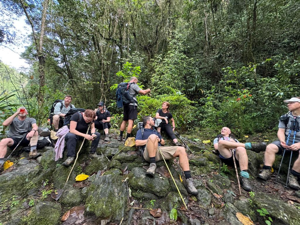
Kokoda is hard because of how relentless it is, not because of any one section. You are rarely on flat ground, and every day brings long climbs followed by steep, slippery descents.
- The climbs. The track crosses the Owen Stanley Range ridge after ridge. Some climbs, such as [e.g. Imita Ridge or the Brigade Hill approach], take hours.
- The descents. For many trekkers, going down is harder than going up. Wet clay and roots put real strain on knees and quads.
- Mud and rain. Rain can fall at any time of year, turning the track slick within minutes.
- Heat and humidity. Valley sections are hot and steamy, so hydration is constant work.
- River crossings. You will wade creeks and cross log bridges, with Guardians on hand at every crossing.
- Day after day. The real test is backing up for eight or more days in a row on tired legs.
How fit do I need to be for Kokoda?
You need to be able to walk uphill for several hours, then do it again the next day. A good benchmark before you leave: a 5 to 6 hour hilly bushwalk with a light day pack, followed by a similar walk the next day, finishing tired but not wrecked.
Age is less important than preparation. We regularly see trekkers in their [50s, 60s and 70s] finish strongly, and fit young trekkers struggle because they skipped hill training.
A simple training plan
Start three to six months out, depending on your current fitness.
- Build a walking base. Walk 3 to 4 times a week, building to 60 to 90 minutes per session.
- Add hills and stairs. Hills, stadium stairs and step-ups are the most useful training you can do. Train the descent too, not just the climb.
- Do long weekend walks. Build to back-to-back long hikes on hilly bush tracks, ideally in the boots you will trek in.
- Strengthen legs and core. Squats, lunges and step-downs protect your knees on steep descents.
- Wear in your gear. Train in your boots, socks and day pack so nothing is new on the track.
See your doctor for a check-up before you commit, especially if you have any existing health concerns.
About the author
Alan Manning is Managing Director of South Sea Horizons, a PNG-owned inbound tour operator based in Kokopo, East New Britain. He has run treks and tours across Papua New Guinea and the Solomon Islands since 2007 and sits on the board of the Tourism Promotion Authority of Papua New Guinea.
How do I book?
Click the link below to see dates, inclusions and pricing, and to book your Kokoda expedition with South Sea Horizons.